- Free Consultation: (813) 222-2220 Tap Here to Call Us


Hillsborough County Flock Camera Map


Hillsborough County Flock Camera Map | Tampa ALPR Camera Locations and Criminal Defense Lawyer
By W.F. “Casey” Ebsary, Jr. – Florida Bar Board Certified Criminal Trial Lawyer
Explore the Interactive Hillsborough County Flock Camera Map
If you’re looking for an interactive map of Automated License Plate Reader (ALPR) cameras in Hillsborough County, you’re probably asking an important question: How widespread is automated vehicle surveillance in Tampa and the surrounding communities?
The interactive map below provides a visual representation of publicly reported Automated License Plate Reader camera locations throughout Hillsborough County. While the map itself is not an official government publication and should not be interpreted as a complete inventory of every camera in operation, it offers valuable insight into the growing use of digital surveillance technology across Tampa Bay.
Whether you travel through Downtown Tampa, Brandon, Riverview, Temple Terrace, Carrollwood, Plant City, or South Tampa, automated camera systems have become an increasingly important investigative tool for law enforcement agencies. Understanding where these systems are reported to exist can help motorists, journalists, researchers, and criminal defense attorneys better understand how modern investigations are conducted
Why Does This Interactive Camera Map Matter?
As a Board Certified Criminal Trial Lawyer practicing throughout Hillsborough County, I have seen how technology has transformed criminal investigations.
Years ago, officers often relied primarily upon eyewitnesses, confidential informants, or traditional surveillance. Today, investigators frequently supplement those techniques with digital evidence, including Automated License Plate Readers, surveillance video, cellular records, and electronic data.
An interactive camera map helps illustrate just how extensive these surveillance networks may be throughout Hillsborough County. It provides a visual perspective that is difficult to appreciate by reading reports alone.
The map may also help explain why investigators were able to quickly locate a vehicle, establish a timeline, or develop investigative leads.
What Does the Interactive Map Show?
The map identifies publicly reported locations where Automated License Plate Reader cameras have been installed or observed.
Depending on the available information, users may be able to visualize camera concentrations throughout:
- Downtown Tampa
- Ybor City
- South Tampa
- West Tampa
- Seminole Heights
- Carrollwood
- New Tampa
- Temple Terrace
- Brandon
- Riverview
- Bloomingdale
- Fish Hawk
- Apollo Beach
- Ruskin
- Sun City Center
- Plant City
- Lutz
- Citrus Park
- Town ‘N’ Country
Rather than viewing surveillance as isolated cameras, the map demonstrates how multiple cameras may create a broader network capable of documenting vehicle movements across a significant geographic area.
How Should You Use the Interactive Map?
The map should be viewed as an educational resource—not as evidence in any particular criminal case.
It can help users understand:
- the reported distribution of ALPR cameras,
- areas where cameras appear to be concentrated,
- major transportation corridors,
- intersections where automated surveillance may occur,
- how investigators might reconstruct vehicle travel using multiple camera observations.
For criminal defense purposes, however, the actual evidence comes from discovery produced in the individual case—not from a publicly available map.
Why Camera Locations Matter in Criminal Defense
Many people assume that a vehicle appearing on an automated camera automatically proves criminal activity.
It does not.
Instead, camera data often serves as one piece of a much larger investigation.
When I defend clients charged with criminal offenses, I carefully examine how investigators used digital evidence. Questions I frequently ask include:
- Where was the vehicle first observed?
- Were multiple cameras involved?
- Does the alleged travel timeline make sense?
- Was additional investigation conducted?
- Did officers independently verify the information before initiating a traffic stop?
Every criminal investigation deserves careful constitutional scrutiny.
What Can the Map Reveal About an Investigation?
Although every case is different, interactive mapping sometimes helps identify issues that deserve closer examination.
| Map Observation | Possible Investigative Question |
|---|---|
| Multiple camera detections | Does the timeline accurately reflect vehicle travel? |
| Long gaps between observations | Were additional investigative methods used? |
| Concentrated camera coverage | How frequently might vehicles be recorded? |
| Major roadway intersections | Why was this location significant? |
| Geographic travel pattern | Does the alleged route match the available evidence? |
These questions do not determine guilt or innocence. Instead, they help guide further investigation by experienced criminal defense counsel.
Where Are Cameras Commonly Located?
Publicly reported ALPR cameras are often found near locations that maximize traffic flow and investigative value.
Examples may include:
| Typical Location | Why Cameras May Be Placed There |
|---|---|
| Interstate entrances and exits | Large volume of passing vehicles |
| Major intersections | Continuous traffic monitoring |
| Commercial corridors | High traffic density |
| Bridges and causeways | Limited travel routes |
| Municipal roadways | Vehicle movement analysis |
| Public infrastructure | Strategic observation points |
The specific locations shown on the interactive map depend upon publicly available reporting and may change over time.
Can the Interactive Map Help Your Defense?
Possibly—but not in the way many people think.
The interactive map itself is generally not evidence.
Instead, it helps identify areas where additional legal investigation may be appropriate.
As a criminal defense attorney, I rely upon discovery, body camera footage, dispatch records, surveillance video, investigative reports, witness statements, and other evidence—not simply publicly available maps.
However, understanding the reported camera network can help generate important investigative questions during the early stages of representation.
Understanding Digital Surveillance in Hillsborough County
Technology continues to reshape criminal investigations.
Digital surveillance may involve:
| Technology | Potential Investigative Role |
|---|---|
| Automated License Plate Readers | Vehicle identification |
| Fixed surveillance cameras | Incident documentation |
| Body-worn cameras | Officer interactions |
| Dash cameras | Traffic stop evidence |
| Cell phone records | Timeline analysis |
| Digital video | Event reconstruction |
Each type of evidence must be evaluated independently.
No single piece of technology should replace careful legal analysis.
Why Experience Matters
Cases involving digital surveillance often require far more than reviewing an arrest report.
They may involve extensive discovery, constitutional analysis, electronic evidence, motion practice, and technical issues unfamiliar to many attorneys.
As a Florida Bar Board Certified Criminal Trial Lawyer, I have spent decades representing individuals charged with serious criminal offenses throughout Hillsborough County and the Tampa Bay area.
When technology becomes part of the prosecution’s case, I carefully evaluate how that evidence was obtained, preserved, interpreted, and presented.
Every investigation deserves an independent review.
Frequently Asked Questions
Is this an official Hillsborough County camera map?
No. The interactive map is intended as a visual reference based on publicly reported camera locations and should not be interpreted as an official government inventory.
Does every camera belong to law enforcement?
Not necessarily. The source material does not establish ownership of every reported camera location. Some cameras may be operated by governmental entities, while others may be associated with private organizations or other users.
Can a Flock camera identify who was driving?
Camera systems generally document vehicles rather than conclusively identifying the driver. Whether the government can prove who was operating the vehicle depends on the totality of the evidence in the case.
If my vehicle appears on camera, does that mean I committed a crime?
No. A camera observation simply documents that a vehicle was present at a particular location and time. Standing alone, it does not establish criminal conduct.
Can digital surveillance evidence be challenged?
Yes. Whether digital evidence may be challenged depends on the facts of the investigation, the applicable law, and how the evidence was obtained and used.
Contact a Tampa Criminal Defense Lawyer

If your investigation involved Automated License Plate Readers, digital surveillance, or other technology-based evidence, I encourage you to seek legal advice as early as possible.
Every criminal case is different, and the significance of digital evidence depends upon the facts unique to your investigation. Early review of discovery and preservation of evidence can be critical to developing an effective defense strategy.
Learn more about W.F. “Casey” Ebsary, Jr.:
https://www.centrallaw.com/lawyers/w-f-casey-ebsary-jr/
Schedule a confidential consultation:
https://www.centrallaw.com/contact-us/
Title
Hillsborough County Flock Camera Map | Tampa ALPR Camera Locations | Criminal Defense Lawyer
Description
Explore an interactive Hillsborough County Flock camera map showing publicly reported ALPR locations throughout Tampa. Learn how automated license plate readers may affect criminal investigations and your legal rights with Board Certified Criminal Trial Lawyer W.F. Casey Ebsary, Jr.
Can Law Enforcement Use the Interactive Camera Map During an Investigation?
The interactive map provides a useful visualization of publicly reported Automated License Plate Reader (ALPR) locations throughout Hillsborough County, but it is important to understand what the map is—and what it is not. The map is not itself evidence, nor does it document the movements of any specific vehicle. Instead, it illustrates where reported camera systems have been identified by the public, helping users understand how an interconnected network of cameras may exist across Tampa and surrounding communities.
For investigators, the actual evidence comes from the records generated by individual camera systems and any related investigative files. For a criminal defense attorney, the map serves as a starting point for asking informed questions about the government’s evidence, discovery, and the sequence of the investigation.
How Can the Interactive Map Help You Understand an Investigation?
One of the most valuable aspects of the map is that it helps visualize how multiple camera locations may intersect with everyday travel. Someone driving from Brandon to Downtown Tampa, commuting through Carrollwood, or crossing the Selmon Expressway may unknowingly pass numerous reported camera locations during a routine trip.
While the map cannot establish whether a particular vehicle was captured, it helps explain how investigators may attempt to reconstruct travel routes. Understanding these reported camera locations may assist in evaluating investigative timelines, identifying potential gaps, and preparing questions about the evidence produced during discovery.
What Roads in Hillsborough County Are Commonly Associated with Heavy Camera Coverage?
Although camera locations change over time and publicly available maps should not be treated as official inventories, reported ALPR installations often appear near major transportation corridors where traffic volumes are highest.
Drivers throughout Hillsborough County frequently travel on roads such as:
| Major Corridor | Community Served |
|---|---|
| Interstate 275 | Downtown Tampa, West Tampa, North Tampa |
| Interstate 4 | Tampa to Plant City |
| Interstate 75 | New Tampa, Brandon, Riverview |
| Selmon Expressway | South Tampa and Brandon |
| Dale Mabry Highway | South Tampa and Carrollwood |
| Bruce B. Downs Boulevard | New Tampa and USF area |
| Hillsborough Avenue | Tampa and Town ‘N’ Country |
| Kennedy Boulevard | Downtown Tampa and Westshore |
| Fowler Avenue | Temple Terrace and University Area |
| Adamo Drive | East Tampa and Ybor City |
These roadways carry thousands of vehicles every day, making them logical locations for traffic-monitoring technology. However, the interactive map—not this article—should be consulted to explore publicly reported camera locations.
Why Camera Density Matters
The interactive map often reveals clusters of reported camera locations rather than isolated installations. This broader view helps readers understand how investigators may rely on multiple observations instead of a single image.
For example, if several reported cameras appear along a common travel route, investigators may attempt to establish a sequence of vehicle sightings. Whether that sequence accurately reflects the facts of a particular case depends on the evidence produced during the investigation, not simply the existence of camera locations on a map.
As a criminal defense attorney, I examine whether the available evidence supports the government’s timeline and whether additional facts are necessary before drawing conclusions.
Can the Interactive Map Reveal Gaps in the Government’s Theory?
Sometimes.
Maps can help identify areas where additional questions may be appropriate. If investigators allege a particular route of travel, understanding where publicly reported cameras are located may assist in evaluating whether the available evidence appears complete or whether further inquiry is warranted.
The map itself cannot answer these questions. Instead, it helps frame the issues that may become important during discovery and motion practice.
Some examples include:
| Investigative Issue | Why It May Matter |
|---|---|
| Large gaps between reported camera locations | May prompt questions about how the alleged route was reconstructed. |
| Numerous reported cameras along a route | May raise questions about what evidence was or was not collected. |
| Unexpected travel pattern | May require further investigation or explanation. |
| Conflicting timelines | May affect the reliability of the government’s chronology. |
Every criminal case must be evaluated on its own facts.
What Evidence Should a Defense Attorney Request?
When digital surveillance may have played a role in a criminal investigation, obtaining complete discovery is essential. The specific materials available will differ from case to case, but I routinely evaluate whether additional records should be requested and reviewed.
Potential areas of inquiry include:
| Discovery Category | Purpose |
|---|---|
| Law enforcement reports | Understand how the investigation developed. |
| Body-worn camera recordings | Review officer observations and interactions. |
| In-car camera video | Evaluate the circumstances surrounding a stop. |
| Dispatch communications | Establish investigative chronology. |
| Surveillance images | Compare with other available evidence. |
| Digital evidence logs | Determine how electronic information was preserved. |
The appropriate discovery requests depend on the unique facts of each case, and not every investigation will involve every category listed above.
Can Technology Replace Police Investigation?
No.
Technology can assist investigators by generating leads, organizing information, and documenting events, but it does not replace the need for careful police work. Officers must still investigate, evaluate evidence, and comply with constitutional requirements.
Likewise, prosecutors retain the burden of proving every element of a criminal offense beyond a reasonable doubt. The existence of digital evidence does not relieve the government of that obligation.
Why Local Experience Matters in Hillsborough County
Criminal cases in Hillsborough County involve unique judges, prosecutors, law enforcement agencies, and local court procedures. As someone who has spent decades practicing criminal law in Tampa, I understand how digital evidence fits into the larger context of criminal litigation.
Whether a case involves a misdemeanor traffic offense, a felony investigation, or allegations supported by electronic evidence, I approach every case by independently reviewing the facts rather than accepting the government’s conclusions at face value.
Technology may change, but the principles of effective criminal defense remain the same: thorough preparation, careful analysis, and a commitment to protecting constitutional rights.
Final Thoughts
In the final section, I’ll cover:
- 15 FAQs focused on Tampa and Hillsborough County.
- Neighborhood-specific content for Downtown Tampa, South Tampa, Ybor City, Brandon, Riverview, Carrollwood, Temple Terrace, Plant City, Lutz, and surrounding communities.
- Featured tables
Frequently Asked Questions About the Hillsborough County Flock Camera Map

The interactive map above displays publicly reported Automated License Plate Reader (ALPR) camera locations throughout Hillsborough County. Depending on the information available from the map’s source, users may find reported camera locations in and around Tampa, Brandon, Riverview, Temple Terrace, Carrollwood, South Tampa, Downtown Tampa, New Tampa, Plant City, Apollo Beach, Ruskin, Lutz, and other Hillsborough County communities. Because camera deployments can change over time, the map should be viewed as a research tool rather than an official inventory maintained by any governmental agency.
No. The interactive map is intended to help visualize publicly reported camera locations and should not be interpreted as an official governmental database. Law enforcement agencies may install, relocate, replace, or remove cameras over time, and not every operational camera will necessarily appear on a publicly available map.
No. The map only illustrates reported camera locations. It does not identify individual vehicles, reveal license plate information, or indicate whether a specific automobile was recorded by any camera system. That type of information, if it exists, would generally come from the records maintained by the entity operating the camera system and may only become available through lawful investigative or legal processes. Likewise, the presence or absence of a marker does not establish whether a particular vehicle was recorded.
Potentially. Whether digital evidence may be challenged depends upon the specific facts of the investigation, the applicable law, and the manner in which the evidence was obtained and preserved. Every criminal case presents unique issues that should be evaluated individually rather than through assumptions about the technology involved.
Why Do People Search for the Tampa Flock Camera Map?
People use the map for many different reasons.
Some residents simply want to better understand how automated vehicle recognition technology is distributed throughout Hillsborough County. Others are journalists, researchers, privacy advocates, or criminal defense attorneys interested in learning how publicly reported camera networks may intersect with heavily traveled roadways.
For individuals facing criminal charges, the map often serves as an educational tool that helps explain how investigators may develop leads using modern surveillance technology.
Can the Map Help Explain a Criminal Investigation?
Sometimes.
One benefit of an interactive map is that it allows users to visualize how reported camera locations relate to major roadways, neighborhoods, and travel corridors throughout Hillsborough County. Understanding the geography of reported camera locations may help explain investigative timelines, although the actual evidence in any criminal case comes from discovery—not the map itself.
As a criminal defense attorney, I use discovery, investigative reports, and other evidence to evaluate how digital surveillance was used during an investigation.
Why Does Local Experience Matter?
Criminal cases are decided on facts—not technology alone.
As a Florida Bar Board Certified Criminal Trial Lawyer, I have spent decades defending individuals charged with crimes throughout Tampa and Hillsborough County. I understand how prosecutors present digital evidence and how careful legal analysis can identify issues that deserve closer examination.
Every investigation should be evaluated independently.
Communities Covered by the Interactive Map
Whether you live in Tampa or simply travel through Hillsborough County, the interactive map provides a valuable overview of publicly reported camera locations throughout the region.
Downtown Tampa
Downtown Tampa serves as the governmental and business center of Hillsborough County, with significant daily traffic generated by office buildings, sporting events, entertainment venues, and the federal and state courthouses. The interactive map helps users understand how reported camera locations relate to this busy urban environment.
South Tampa
South Tampa includes some of the county’s most heavily traveled commercial corridors and residential neighborhoods. Drivers traveling between MacDill Air Force Base, Hyde Park, Bayshore Boulevard, and Downtown Tampa may wish to explore reported camera locations using the interactive map.
Brandon
As one of Hillsborough County’s largest suburban communities, Brandon experiences substantial commuter traffic. The map provides a visual reference for understanding publicly reported camera locations serving this growing area.
Riverview
Rapid residential and commercial development has made Riverview one of the county’s busiest transportation hubs. The interactive map helps illustrate reported camera locations near major travel corridors.
Carrollwood
Carrollwood’s proximity to Veterans Expressway, Dale Mabry Highway, and surrounding commercial districts makes it an important area for understanding regional traffic patterns reflected on the map.
Temple Terrace
Temple Terrace and the University of South Florida area generate consistent traffic throughout the year. The map offers users an opportunity to explore publicly reported camera locations throughout this portion of Hillsborough County.
New Tampa
New Tampa continues to experience significant residential growth. Residents and commuters alike can use the interactive map to better understand reported surveillance infrastructure throughout the area.
Plant City
Known for agriculture, logistics, and Interstate access, Plant City serves as an important connection between Tampa and Central Florida. Publicly reported camera locations displayed on the map may help illustrate regional transportation routes.
Apollo Beach, Ruskin, and Sun City Center
Southern Hillsborough County has experienced tremendous growth over the past decade. The map allows users to explore reported camera locations serving these expanding communities and the roadways connecting them to Tampa.
Lutz and Citrus Park
Northern Hillsborough County continues to develop rapidly. Drivers traveling between Hillsborough and Pasco Counties can use the interactive map to visualize reported camera locations throughout the region.
Why Choose W.F. “Casey” Ebsary, Jr.?
Technology has transformed criminal investigations, but constitutional protections remain the cornerstone of every criminal case. If your arrest followed a traffic stop or investigation involving Automated License Plate Readers, digital surveillance, or other electronic evidence, you deserve an attorney who understands both the law and the technology.
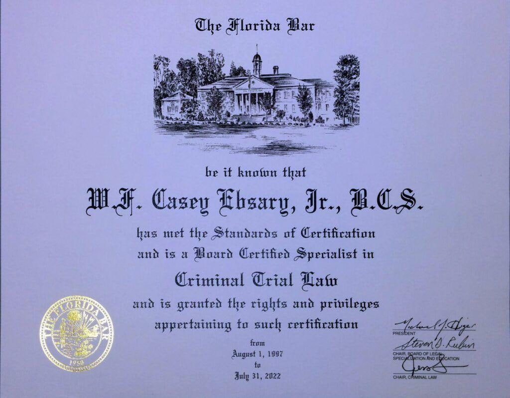
As a Florida Bar Board Certified Criminal Trial Lawyer, former prosecutor, and longtime Tampa criminal defense attorney, I carefully evaluate the evidence, review the discovery, and identify legal issues that may affect the outcome of your case. My approach is based on thorough preparation, strategic motion practice, and a commitment to protecting my clients’ rights at every stage of the proceedings.
If you have questions about a criminal investigation involving digital surveillance in Hillsborough County, I invite you to learn more about my experience and contact my office for a confidential consultation.
Attorney Bio: https://www.centrallaw.com/lawyers/w-f-casey-ebsary-jr/
Contact My Office: https://www.centrallaw.com/contact-us/
Related Resources
To learn more about technology-related criminal defense issues, you may also find these topics helpful:
| Resource | Purpose |
|---|---|
| Tampa Criminal Defense Attorney | Overview of criminal defense representation |
| DUI Defense in Tampa | Representation for DUI investigations and prosecutions |
| Search and Seizure | Understanding constitutional protections |
| Digital Evidence | Legal issues involving electronic evidence |
| Motion to Suppress Evidence | Challenging unlawfully obtained evidence |
Hillsborough County Flock Camera Map | Tampa ALPR Camera Locations | Board Certified Criminal Defense Lawyer
Summary
Explore the interactive Hillsborough County Flock Camera Map with publicly reported ALPR locations across Tampa, Brandon, Riverview, Temple Terrace, Plant City, and surrounding communities. Learn how automated license plate reader technology may affect criminal investigations from Board Certified Criminal Trial Lawyer W.F. Casey Ebsary, Jr.